
 English

 Francais


1 ) Startup
It runs on PC and it has been developed in Java, you will have install a JRE JavaNormally, just double-click on the last version of NoniMapView.exe.jar and that's all.
But you can also execute the same NoniMapView.jar you to add options:
java -Xmx1024M -jar NoniMapViewV0.30.jar
An example of use here
Warning: GoogleMap severely limits the use of its Satellites maps, in cases of abuse, you can be 'banish' for 24 hours
For the first time, it will ask for the directory cache (yes or select a directory).
1 - 1 ) The functions
| Select area | To select the area to download: Click on it, and then select the area on the map. This must appear en read. |
| Latitude, Longitude, Top Left, Bottom right | To display of manually enter the coordinates of the area (in decimal) |
| Zoom level area | To adapt the display to the selected area |
| Zoom level Zoom | Select then click on the map to zoom on a point |
| Display | To setup the display zoom level |
| Download | To setup the download zoom level |
| Split | To split the map |
| Size | provides you information on the size of the selected area |
| Main Display | Allows you to choose the main source of the map (GoogleMap, Yahoo etc ...) |
| Sub Display | To select the secondary source map to mix different sources. |
2 ) The + of MoniMapView
2 - 1 ) The possibility of combining
The info of satellites vues and road vues from Yahoo and Google (Main Display and Sub Display):A view from Google:
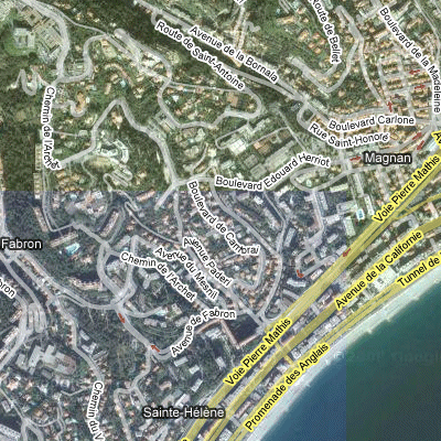
A view from Yahoo:
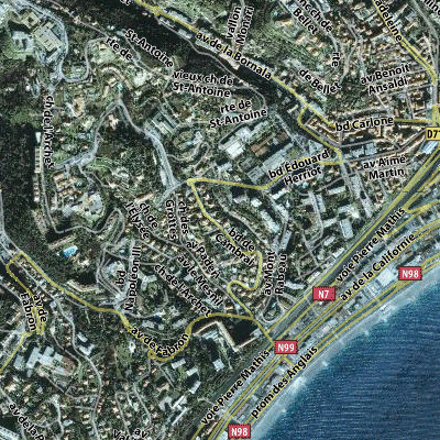
A view from Yahoo with Google road info:

2 - 2 ) The SubSampling
(may be deactivated in the window configuration)The idea is that if a portion of the map is not available in the zoom selected, NoniMapView is able to zoom a lower zoom to not generate a map half empty.
2 - 3 ) The multithread
(may be deactivated in the window configuration)NoniMapView is able to recover several titles at the same time.
It is not advisable with Google to avoid being banned too fast.
2 - 4 ) The multi-proxi
is very complex to implement and it is better to have Network knowledgeIf you know several proxy assets.
For example, retrieving them from
http://www.publicproxyservers.com/page1.html
and by checking with
http://www.checker.freeproxy.ru/checker/ (http proxie Goog look at a late check)
NoniMapView is able to use them all at the same time
In Proxy List, bringing the list of proxy in the form [proxy: port]
For example:
203.144.160.244:8080
80.191.83.5:3128
Warning: a proxy are only rarely valid for a long time.
2 - 5 ) It can read traces NoniGPSPlot
and save them as imagesIt is possible to display some information by placing the cursor on the trace:
